CONCAM —ING’s All-Sky Camera
René Rutten (ING)
It
has been a long-standing wish at the observatory to have a night-time all-sky
cloud monitor. A cloud monitor, in the first place, allows astronomers in
the control room to assess the actual situation of the night sky without the
need of having to rush out for a visual check. The latter usually requires
rushing up and down stairs, standing in the cold outside, and waiting for
the eyes to get adapted to the dark, and even then one would only have a partial
snapshot of the situation in the sky.
The ideal cloud monitor works at infrared wavelengths where the contrast
between the cloudless night sky and the relatively warm clouds is high. However,
a suitable infrared camera is rather complex and expensive to build, and as
the equipment has to be located outside, there is a significant maintenance
overhead as well. To avoid these problems we have been looking for an alternative
for some time and came across CONCAM.
|
|

|
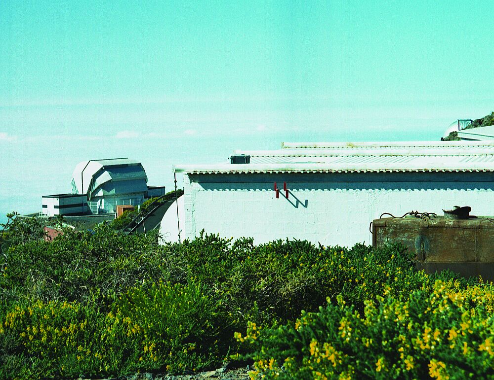
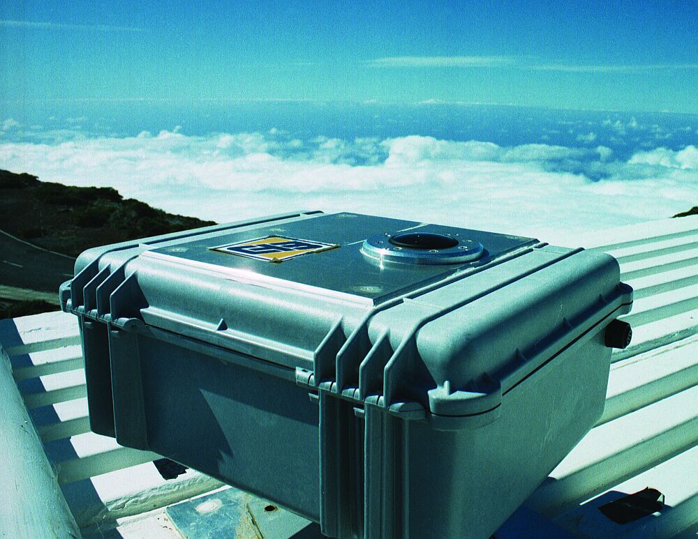
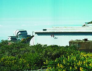
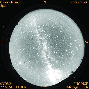
| Top left: CONCAM on the roof of the
liquid nitrogen plant [ JPEG | TIFF ]. Bottom left: A closer view of CONCAM
[ JPEG | TIFF ]. Right:
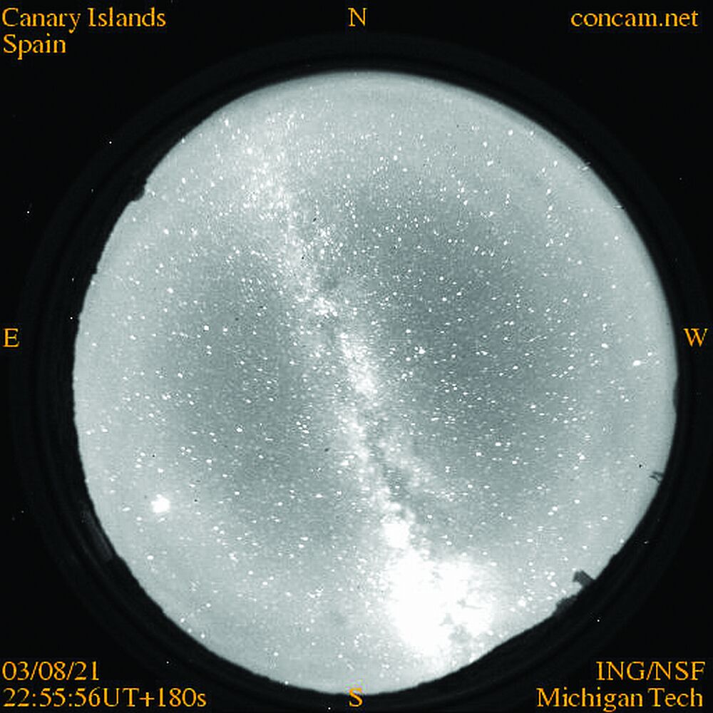
CONCAM image of the Palmeran night sky [ JPEG
| TIFF ].
|
CONCAM stands for CONtinuous CAMera, designed and built by Robert Nemiroff
and his team at Michigan Technical University. It is a well designed and built,
self-contained system that only requires connecting to electrical power and
the internet. CONCAM consists of a fish-eye lens that projects the night
sky onto an SBIG CCD camera. The camera itself is controlled by a small notebook
PC. The full system sits in a small, well-sealed weather tight box, located
on the roof of the liquid nitrogen plant building, close to the junction
of the road leading up to the WHT.
The camera switches itself on during evening twilight and stops at the end
of the night. Images are taken every couple of minutes, and exposure times
are up to a few minutes during moon-less periods. Data is automatically transferred
to Michigan, and immediately bias corrected and flat fielded. The reduced
data and nightly movies are then made available on the web through the on-line
CONCAM archive at Michigan (see
http://nightskylive.net/).
Copies of the reduced (and compressed) nightly movies are archived locally
on La Palma and available at
http://catserver.ing.iac.es/weather/archive/index.php
(follow the link to the archive and select the required day).
Currently, CONCAM systems are installed not only on La Palma, but also at
Mauna Kea, Kitt Peak, Mt Wilson, Wise Observatory (Israel), Rosemary Hill
(Florida), South Africa and Siding Spring.
The initiative leading to the development of CONCAM was centred around the
idea of monitoring the brightness of relatively bright objects and to permanently
look for bright transient events across the whole sky. Besides these primary
goals, CONCAM also offers very good possibilities for stimulating public interest,
as the sequence of CONCAM images very clearly demonstrate how the sky varies
during nights. CONCAM images can show a number of interesting atmospheric
and night-sky features. CONCAM shows of course the position of planets and
the moon, but also shows the zodiacal light, it announces sunrise and sunset,
and even makes visible the patterns in the OH night sky lines. An excellent
set of examples of what CONCAM sees is shown at
http://www.concam.net/phenomena.html.
For ING, however, the main role it serves is that of all-sky cloud monitor.
The all-sky movies that are automatically generated give a very good visual
impression of transparency variations across the sky, and how it varies in
time. Clouds can be seen rolling in, allowing the astronomer to take advantage
of the best parts of the sky and plan the observing programme. Together with
the weather maps, the meteorology data, and the robotic seeing measurements,
ING now possesses a comprehensive set of tools for planning observations and
assessing post-observing data quality.
We are very grateful for the superb collaboration and assistance received
from the team at Michigan Technical University, in particular from Robert
Nemiroff and David Crook.
¤
Email contact: René
Rutten (
rgmr@ing.iac.es)